

1
of
2
Loading...
SKU:
3P1920
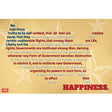
Declaration of Independence Map Mini-Poster
Regular price
$5.99
Unit price
Shipping calculated at checkout.


Declaration of Independence Map Mini-Poster
Regular price
$5.99
Unit price

Declaration of Independence Map Mini-Poster
Description
Description
Where did the signers come from? What did the young nation look like in 1776?
Add geographic context to the Declaration of Independence.
This mini-poster connects the founding document to the map, helping students picture the colonies that declared their independence. It's a great visual for Revolutionary War and civics units.
History meets geography. A quick reference for your founding-era lessons.
Thirteen colonies, one declaration.
3P1920: 13 x 19 inches, cardstock. ©2015.
Reviews (0)
Reviews (0)
Payment & Security
Payment methods
Your payment information is processed securely. We do not store credit card details nor have access to your credit card information.